Cambridge scientists and PhD students are at the forefront of monitoring the activity of the Bárðarbunga volcano in Iceland. The research group, led by Professor Bob White of the Department of Earth Sciences, is monitoring the ongoing massive volcanic intrusion through its array of seismic instrumentation - never before has such an intrusion been so well documented. The data they gather is likely to yield considerable new insights into how molten rock moves underground, and whether or not it erupts. Here, Professor White outlines the team’s ongoing work in Iceland.
Cambridge scientists and PhD students are at the forefront of monitoring the activity of the Bárðarbunga volcano in Iceland. The research group, led by Professor Bob White of the Department of Earth Sciences, is monitoring the ongoing massive volcanic intrusion through its array of seismic instrumentation - never before has such an intrusion been so well documented. The data they gather is likely to yield considerable new insights into how molten rock moves underground, and whether or not it erupts. Here, Professor White outlines the team’s ongoing work in Iceland.
Bárðarbunga is huge – at 350 million cubic metres it is already twice the size of the Eyjfjallajökull eruption in 2010 which forced the cancellation of more than 100,000 airline flights
Bob White
The volume of magma on the move under and beyond Bárðarbunga is huge – at 350 million cubic metres it is already twice the size of the Eyjfjallajökull eruption in 2010 which forced the cancellation of more than 100,000 airline flights.
In the last 24 hours, an extra 50 million cubic metres of magma has been injected into the system. That is equivalent to the volume of 20,000 Olympic-sized swimming pools in just one day. The volcano is also rifting a huge length of the dyke network, and molten rock continues to move over 40 kilometres northwards, between five and ten kilometres underground.
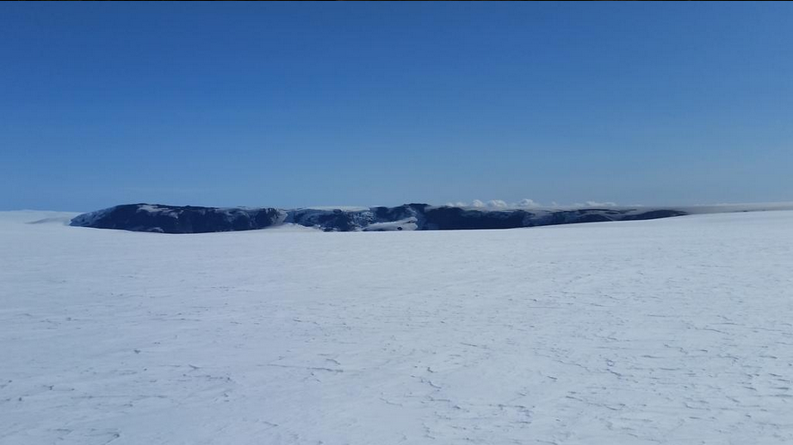
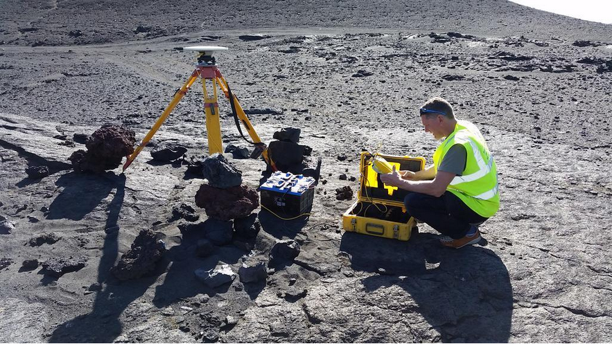
Since 2006, our group has been monitoring the area in which the volcanism is occurring using up to 70 broadband seismometers. These are partly Cambridge owned, but are predominantly loaned for research by the Natural Environment Research Council (NERC).
Fortuitously, the seismometers and field researchers were still in Iceland at the time that this most recent activity began, as our team had recently finished recovering 25 seismometers from the Vatnajökull ice cap where they had been used for a study of small quakes caused by ice cracking.
Within 24 hours of the start of this magmatic intrusion, Cambridge researcher Tobba Ágústsdóttir had joined others from the Icelandic Meteorological Office (IMO) and the Earth Sciences Institute of the University of Iceland on a Coast Guard helicopter flight to the Vatnajökull ice cap where she was able to deploy one of the Cambridge NERC seismometers close to the site of activity on an IMO site that telemetered the data to Reykjavik. Over subsequent days, using snow scooters and IMO colleagues she was able to deploy three more seismometers on the Vatnajökull ice cap to track the movement of the molten rock northwards.

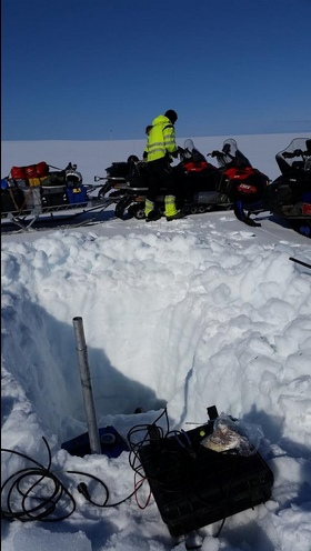

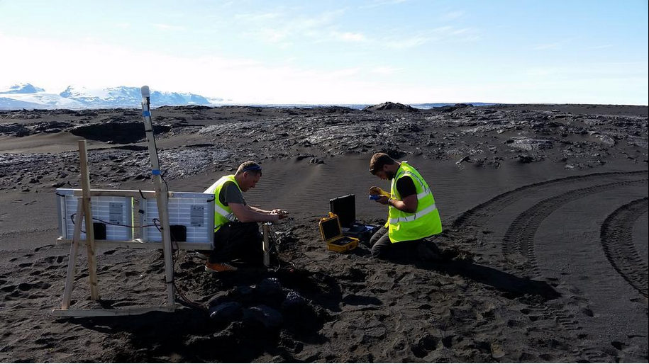
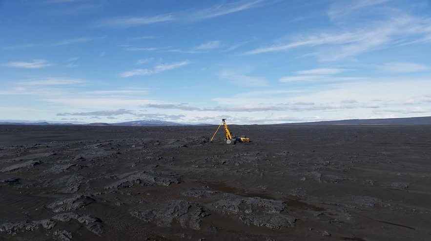

The newly-deployed Cambridge seismometers, plus three other Cambridge instruments deployed the previous year, and telemetered by IMO from three different sites are crucial for the 24/7 real-time tracking by IMO of the seismicity because they are the closest to the activity. The aviation and civil hazard warnings in place in Iceland depend heavily on the IMO tracking of the seismicity.
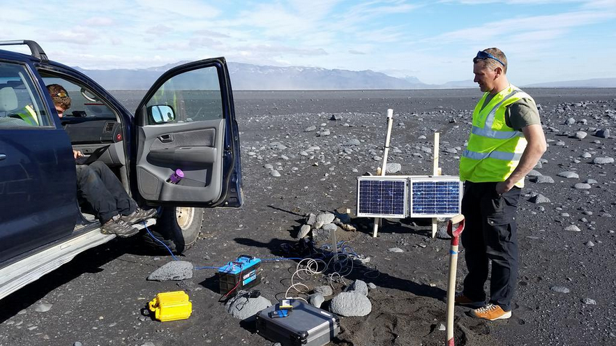
At the time of writing, the Cambridge team have driven into the restricted area around Askja to deploy additional instruments above the tip of the propagating dyke, and to service and download the rest of the seismometer array which record automatically without telemetering the data.
If the dyke continues northwards into the Askja system it could liberate a huge volume of melt that is hanging around there at several depths - this underground melt has already been mapped and published by our group. At present the dyke is headed straight for it. The massive eruption of Askja in 1875 led to the depopulation of northeast Iceland as ash-fall made subsistence farming impossible, so a repeat scenario of that massive eruption remains on the cards. But the future is uncertain and the dyke may not reach that far. That is why continued monitoring is so important.
Professor Páll Einarsson, geophysicist at the University of Iceland, commented: “It is already clear that the event presently in progress is a significant magmatic and tectonic event. In terms of seismicity, volumes, and displacements involved only two events in recent decades are comparable to this one. These are the Gjálp eruption in the Bárðarbunga area in 1996 and the Krafla rifting episode of 1975-1989. The presently propagating dyke is superseded by only the initial dyke in the Krafla sequence of dykes. In fact, is resembles that event in many ways. The possibility must be seriously considered that we are witnessing the initial phase of a major rifting episode on the scale of the Krafla episode and the similar episode that began in Afar in 2005.”
Inset image: Selection of images by Tobba Ágústsdóttir.
Follow Tobba on Twitter to catch the latest developments: @fencingtobba
Follow Professor Simon Redfern (also on site): @Sim0nRedfern
Update: notes from researcher Robert Green on Holuhraun eruption - Sunday 31st August
6:00 Eruption sighted on webcams
6:10 Woken to news of possible eruption
6:15 Leave the hut and drive towards eruption site. Martin Hench on the radio reports that there is almost no tremor on the seismometers.
6:40 We get visual confirmation of the eruption. It is a longer fissure eruption with complete curtain of fires long the line. Fire fountains are more vigorous than last time
6:53 Continuing level of fire fountains which are about 30m high or double the height of the highest crater in the centre. It gets smaller to North where we are maybe 300m away from. Took video and photos
6:57 The activity in the old crater row is the greatest with these having the largest fire fountaining. It is smaller to the north where it has extended further. One of our stations is likely to be covered by a lava flow moving east. Sveinbjorn left quietly and rescued our seismic station which was 20m away from the advancing lava flow.
7:08 The fissure has just extended to the north, this is what people who are at different positions are saying over the radio. Baldur has set up the infra red camera which is streaming to IMO.
7:20 We approached the east lava flow up close which is moving forward still.
There is still very little plume but what there is being emitted is white.
7:25 The wind direction has switched to be more southerly and strengthened. There is a big sandstorm so we gather the cars to leave.
7:50 We are still at the waiting point. In a brief view through the sand the eruption is continuing at the same level. The plume is getting darker on the south side as the fire fountaining there dies down. The north end continues as before.
Note that the early activity must have been considerably elevated from what we see now to have made the large lava flow to the east of the fissure. Flow is roughly 800m long as it reached just about to our station HOLU
8:00 We leave the eruption site.
8:15 Benni reports on the radio that there is more lava flow.
The text in this work is licensed under a Creative Commons Licence. If you use this content on your site please link back to this page. For image rights, please see the credits associated with each individual image.


