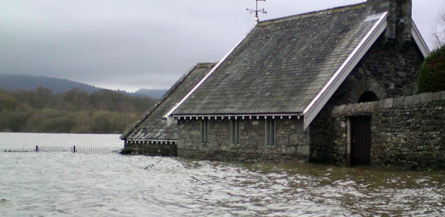
The recent ‘unprecedented’ flooding in north-west England might be more common than currently believed, a group of scientists has warned.
The recent ‘unprecedented’ flooding in north-west England might be more common than currently believed, a group of scientists has warned.
Analysis shows that 21st-century floods are not unprecedented in terms of both their frequency and magnitude."
Tom Spencer
A team of experts from the Universities of Aberystwyth, Cambridge and Glasgow have drawn on historic records to build a clearer picture of the flooding.
They conclude that 21st-century flood events such as Storm Desmond are not exceptional or unprecedented in terms of their frequency or magnitude, and that flood frequency and flood risk forecasts would be improved by including data from flood deposits dating back hundreds of years.
Dr Tom Spencer from the University of Cambridge said: “In the House of Commons on Monday (December 7), the Environment Secretary called the flooding in north-west England ‘unprecedented’ and ‘consistent with climate change trends’. But is this actually true?
“Conventional methods of analysing river flow gauge records cannot answer these questions because upland catchments usually have no or very short records of water levels of around 30 or 40 years. In fact, recent careful scientific analysis of palaeoflood deposits (flood deposits dating back hundreds of years) in the UK uplands shows that 21st-century floods are not unprecedented in terms of both their frequency (they were more frequent before 1960) and magnitude (the biggest events occurred during the 17th–19th centuries).”
Professor Mark Macklin, an expert in river flooding and climate change impacts at Aberystwyth University, said: “UK documentary records and old flood deposits dating back hundreds of years indicate that these floods are not unprecedented, which means we are grossly underestimating flood risk and endangering peoples’ lives.
“In some areas, recent floods have either equalled or exceeded the largest recorded events and these incidences can be ascribed to climate variability in Atlantic margin weather systems.
“It is of concern that historical data suggests there is far more capacity in the North Atlantic climate system to produce wetter and more prolonged flood-rich periods than hitherto experienced in the 21st century. Looking forward, an increased likelihood of weather extremes due to climate change means that extending our flood record using geomorphology science must be placed at the centre of flood risk assessment in the UK.”
Professor Macklin suggests that new approaches to flood risk analysis be adopted to include instrumental, documentary and most importantly palaeoflood records.
He added: “Current approaches using flood frequency analysis and flood risk assessment based on 40-50 year long flow records are far shorter than the design life of most engineering structures and strategic flood risk planning approaches. They are not fit for purpose now, let alone in a changing climate.”
Professor John Lewin from the University of Aberystwyth said: “What is needed, is far more resilience for already-developed floodplains, and much more serious insistence that future floodplain development should be virtually curtailed. Somewhere along the line floodplain development has been allowed by local authorities and the UK government to continue regardless.”
Dr Larissa Naylor from the University of Glasgow said: “These floods and the 2013/14 storms have shown us that our landscape is dynamic rather than static – where rivers reshape floodplains and erosion remodels our coastline – with large economic and social costs. We need to urgently consider how we plan our cities and towns, and rebuild in the wake of large flood and storm events, to live safely in our changing landscape.”
Spencer, Lewin, Macklin and Naylor are members of the British Society for Geomorphology’s Working Group on Stormy Geomorphology, who are currently finalising a global state-of-the-art analysis of the role geomorphology science can play in an age of extremes in the Wiley journal Earth Surface Processes and Landforms.

The text in this work is licensed under a Creative Commons Attribution 4.0 International License. For image use please see separate credits above.


