Learning from when the earth moves
Indonesia plans to build a new capital city from scratch. Protecting the new city from the effects of earthquakes will be crucial. Here's how researchers are helping.

Professor Nick Rawlinson is fascinated by the shifting crust of the planet, the jostle of tectonic plates, the rupture of faults and the shaking of the earth.
As a seismologist, he uses instruments that convert vibrations from deep in the earth into the electronic ‘signatures’ of an earthquake.
Beyond the fascination, however, Rawlinson is keenly aware of the human and economic cost of natural hazards. Half Bornean, he recounts the shock of hearing of the 2015 Sabah earthquake. “Part of the summit of Mount Kinabalu fell, killing 18 people including schoolchildren and their teachers.
“From that point on, I refocused my work away from a more fundamental understanding of earth processes towards working with Indonesian and Malaysian scientists in Borneo on earthquake hazard.”
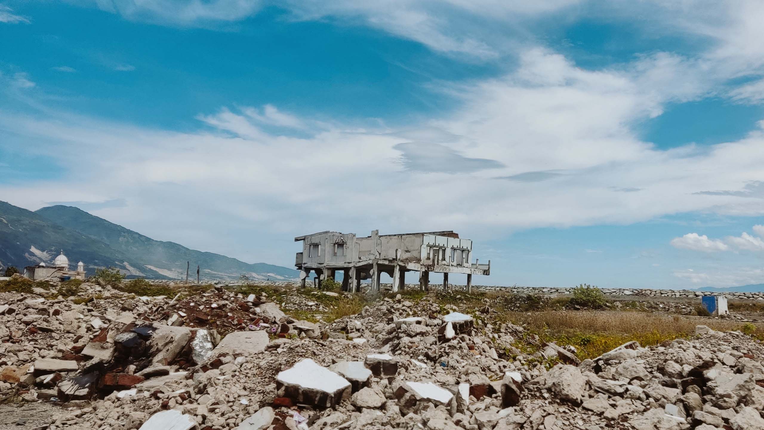
Indonesia experiences around 300 significant natural disasters per year. In recent times, one of the most devastating was in 2018 when an earthquake and tsunami largely destroyed the city of Palu, killing 4,500 people, resulting in 200,000 refugees, and costing the Indonesian economy an estimated US$911 million.
“Natural hazards like earthquakes, tsunamis and volcanic eruptions are unstoppable,” explains Rawlinson. “But the impact can be changed if the built environment has been constructed to mitigate their effects.”
So when, in 2019, the Indonesian parliament announced it would move its capital from Jakarta to East Kalimantan in Borneo and build a new city, Nusantara, Rawlinson and his Indonesian partners saw a rare opportunity to advise on building with safety in mind.
Indonesia’s goal is to build an ‘eco-city’ that will be the hub of stable governance in the country for the decades and centuries to come. It’s a bold ambition, and not without its critics – concerns have been raised about destruction of the rainforest in Borneo, about cost and about what will happen to Jakarta itself.
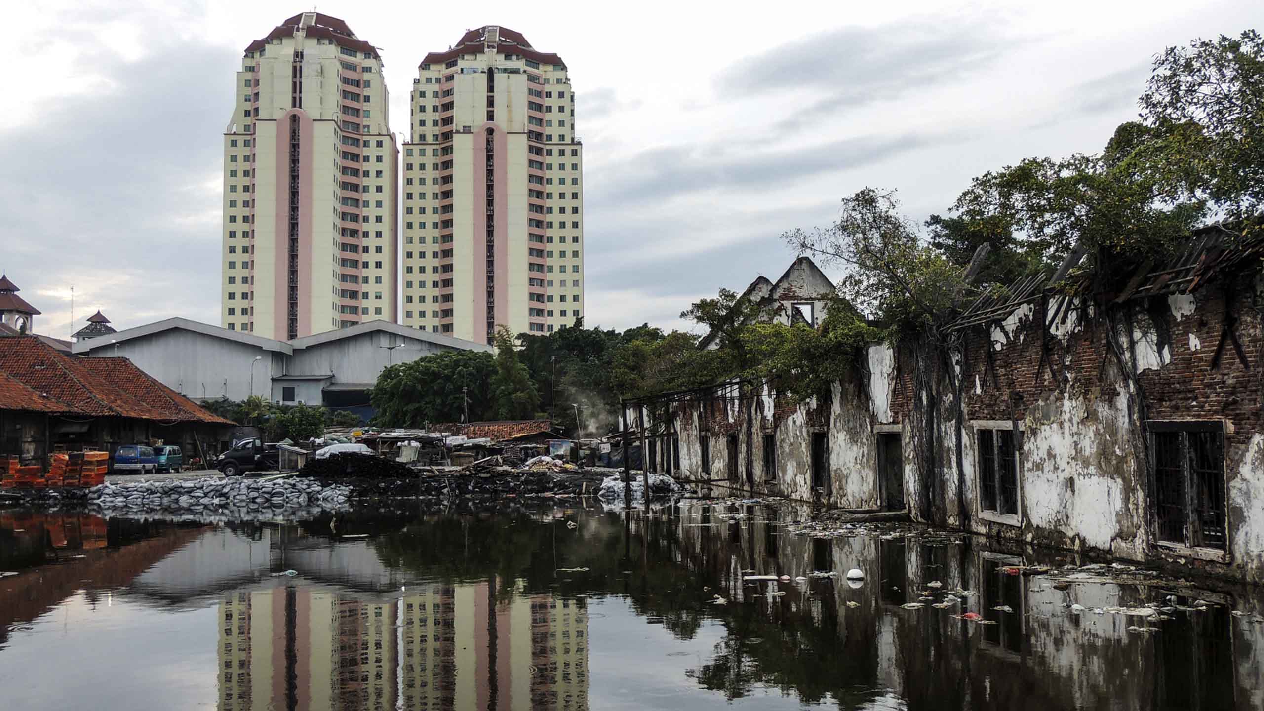
“Notwithstanding these concerns, the fact is that Jakarta is now a very risky city to live in,” says Rawlinson. “Uncontrolled urbanisation has led to overcrowding, pollution and regular flooding. The city is literally sinking. Nearly half of it is below sea level and the extraction of groundwater has led to further subsidence. Add to this the threat of earthquakes and eruptions from nearby volcanoes and you have a perilous situation.”
On the surface, Nusantara looks like a safer setting. But scientists are worried about its proximity to the Palu earthquake and the confluence of four tectonic plates near the site.
Indonesia's current capital city, Jakarta, is one of the fastest-sinking cities in the world.

For the past five years, Rawlinson’s team in the Department of Earth Sciences has been working with Indonesian researchers at the Institut Teknologi Bandung (ITB), led by Professor Sri Widiyantoro, to build an earthquake hazard map for Borneo.
When the location of the new capital was announced, the partnership deployed an additional array of seismic stations even closer to the proposed site of the city, funded by the British Council through a Newton Impact award.
The location of the new capital is across the Makassar Strait from the tectonically active island of Sulawesi, which has implications for seismic hazard in eastern Borneo. The aim of the researchers was to identify any previously undiscovered active faults, image in detail the shallow structure beneath the proposed site, and use the results to drive a better understanding of earthquake hazard in and around the new capital.
“If a new city is to be built, our work could inform building codes and disaster management planning, which would help save lives and reduce economic loss,” explained Rawlinson.

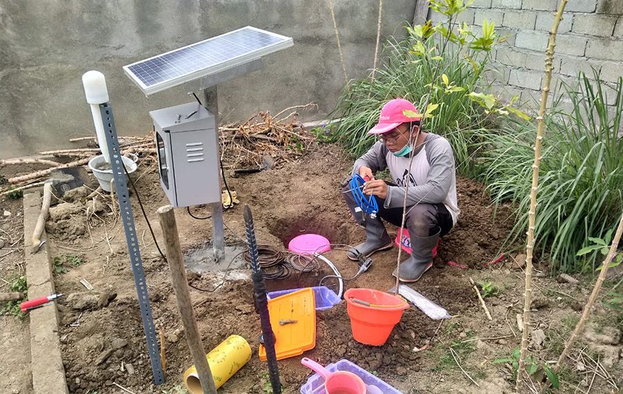
Researcher from the Institut Teknologi Bandung in Indonesia installs one of the seismic stations close to the proposed site of the new capital (credit: ITB)
Researcher from the Institut Teknologi Bandung in Indonesia installs one of the seismic stations close to the proposed site of the new capital (credit: ITB)
After a year of measuring seismic activity, the researchers are now analysing data from the seismometers in the location of the proposed capital: “Fortunately, early analysis has not revealed anything unexpected,” says Rawlinson, “no evidence yet of active faults or unusual seismicity in the area.”
Meanwhile, the combined results of previous and recent work have provided unprecedented seismic data coverage of the region, which can inform ongoing construction of the city.
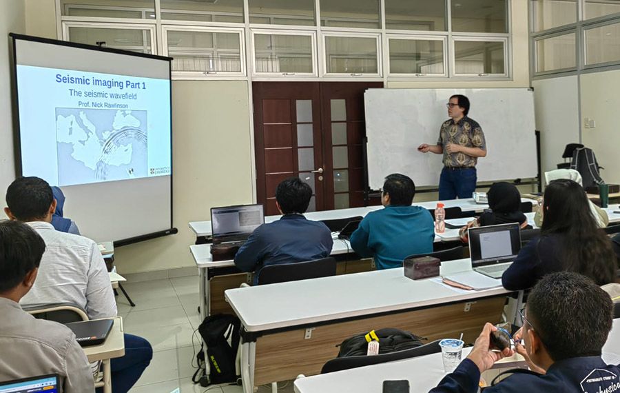
Nick Rawlinson teaching a class at Institut Teknologi Bandung (credit: Nick Rawlinson)
Nick Rawlinson teaching a class at Institut Teknologi Bandung (credit: Nick Rawlinson)
Crucially, to maximise the impact from the project, Widiyantoro is working with the National Earthquake Study Centre (PuSGeN) of the Ministry for Public Works and Housing (PUPR), who are responsible for developing seismic hazard maps of Indonesia. This institution also assists the Indonesian President in formulating policy and coordination around planning and infrastructure development for roads, buildings and other infrastructure.
“Our data is being used to improve regional probabilistic seismic hazard maps,” explains says Widiyantoro. “PUPR has been very supportive of this work and our collaboration with Cambridge.”
“The data is available in an open access regional database of information, which will be critical to setting appropriate building codes and informing disaster management planning.”
Professor Sri Widiyantoro, Institut Teknologi Bandung
Adds Rawlinson: “Ultimately, our goal is to help decision-makers understand earthquake risk to ensure the long term viability of the new capital. The long-term aim of the partnership is to continue to improve earthquake science across Indonesia, ready for the next time the earth moves.”


Published 14 November 2023
With thanks to Nick Rawlinson and Sri Widiyantoro
Written by Louise Walsh
Image credits
Palu: Amalia Indah Rozi/Getty Images
Jakarta: VladCa/Getty Images
The text in this work is licensed under a Creative Commons Attribution-NonCommercial-ShareAlike 4.0 International License