SEA CHANGE

The coast is an intrinsic part of British identity – and perhaps nowhere is it more at risk than in the East of England. Cambridge researchers are working with communities and organisations across the region to manage the coast for the future, by working with nature rather than against it.
“It's not about controlling nature but
working with it.”
It was the worst natural disaster experienced by Britain in the 20th century. On 31 January 1953, the east coast was battered by high tides, storm surge, wind and large waves, leading to devastating flooding. In Norfolk, Suffolk, Essex and Lincolnshire, 307 people were killed. Nineteen were killed in Scotland, while across the North Sea in The Netherlands, 1,800 people lost their lives.
There is plenty of blame to go around for the 1953 disaster, although most would point the finger at the absence of a coordinated warning system, which meant that many communities were unaware of the imminent risk until it was too late. Coastal defences such as sea walls had not been properly maintained or were not equipped to deal with the ferocity of the conditions that night.
In the aftermath of the 1953 flooding, major improvements were made and the UK now has one of the best storm forecasting systems in the world. Existing coastal defences were improved, and new ones like the Thames Barrier were built.
The Thames Barrier is an example of a ‘hard’ coastal defence: in many parts of the country, such as where there is important infrastructure or a major population centre, this is the most appropriate protection against rising tides or storms.
But for a country whose cultural and historical identity is so closely associated with the sea, are large concrete or metal barriers always the best defence? And – less romantically – given the enormous financial cost of these defences, are there other effective and sustainable methods we could consider?


“It’s important to develop plans which enable us to adapt to a changing environment.”
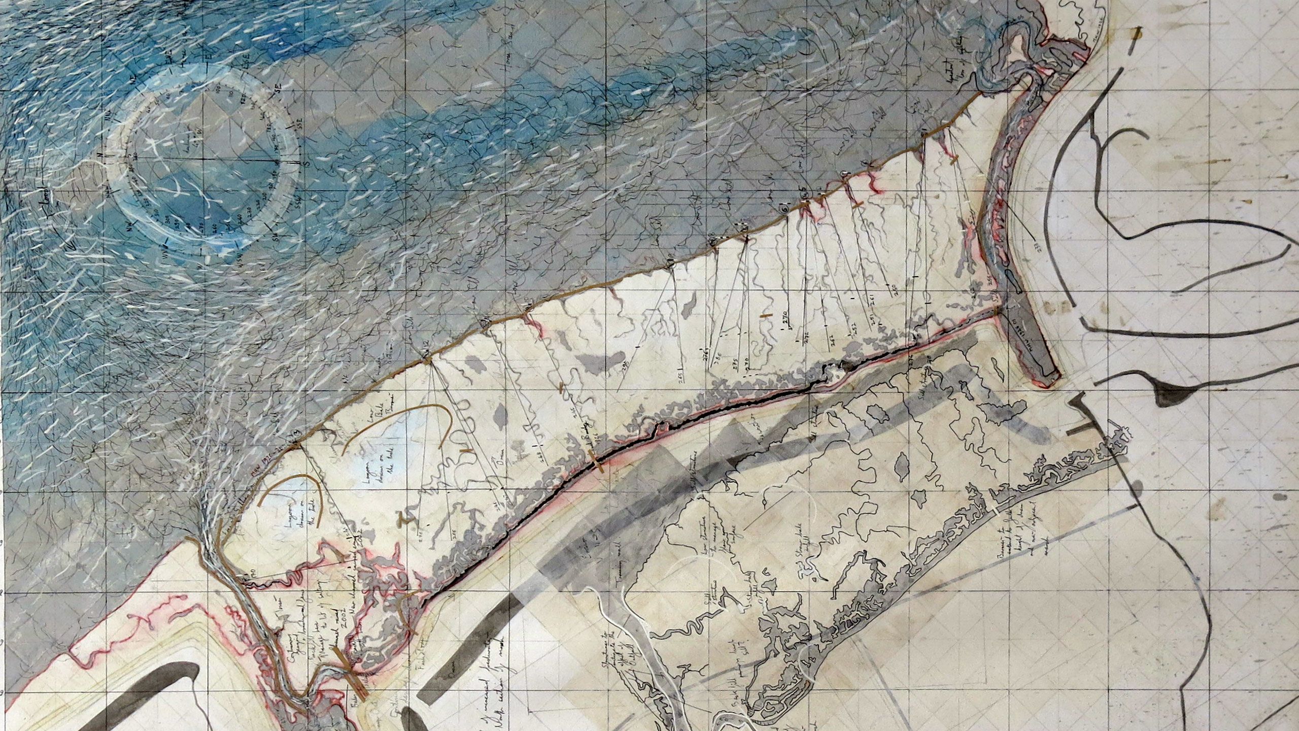
“Many of the coastal defences that were strengthened following the 1953 storm surge are now reaching the end of their natural design life, and it’s expensive to repair or reconstruct these sorts of structures,” says Professor Tom Spencer from Cambridge’s Department of Geography, and Director of the Cambridge Coastal Research Unit.
“If you start to think about the predicted sea level rise and severe storms due to climate change, you might need to replace existing defences with something even higher, which is not as simple as adding a bit on top of an existing structure.”
Spencer and Deputy Director Dr Iris Möller are studying how coastal communities can work with nature, rather than against it, to protect them from flooding. The researchers are collaborating with local authorities in the East of England, the Environment Agency, stakeholders including the National Trust, and the Universities of East Anglia (UEA) and Essex, to develop and test more sustainable approaches to flood defence.
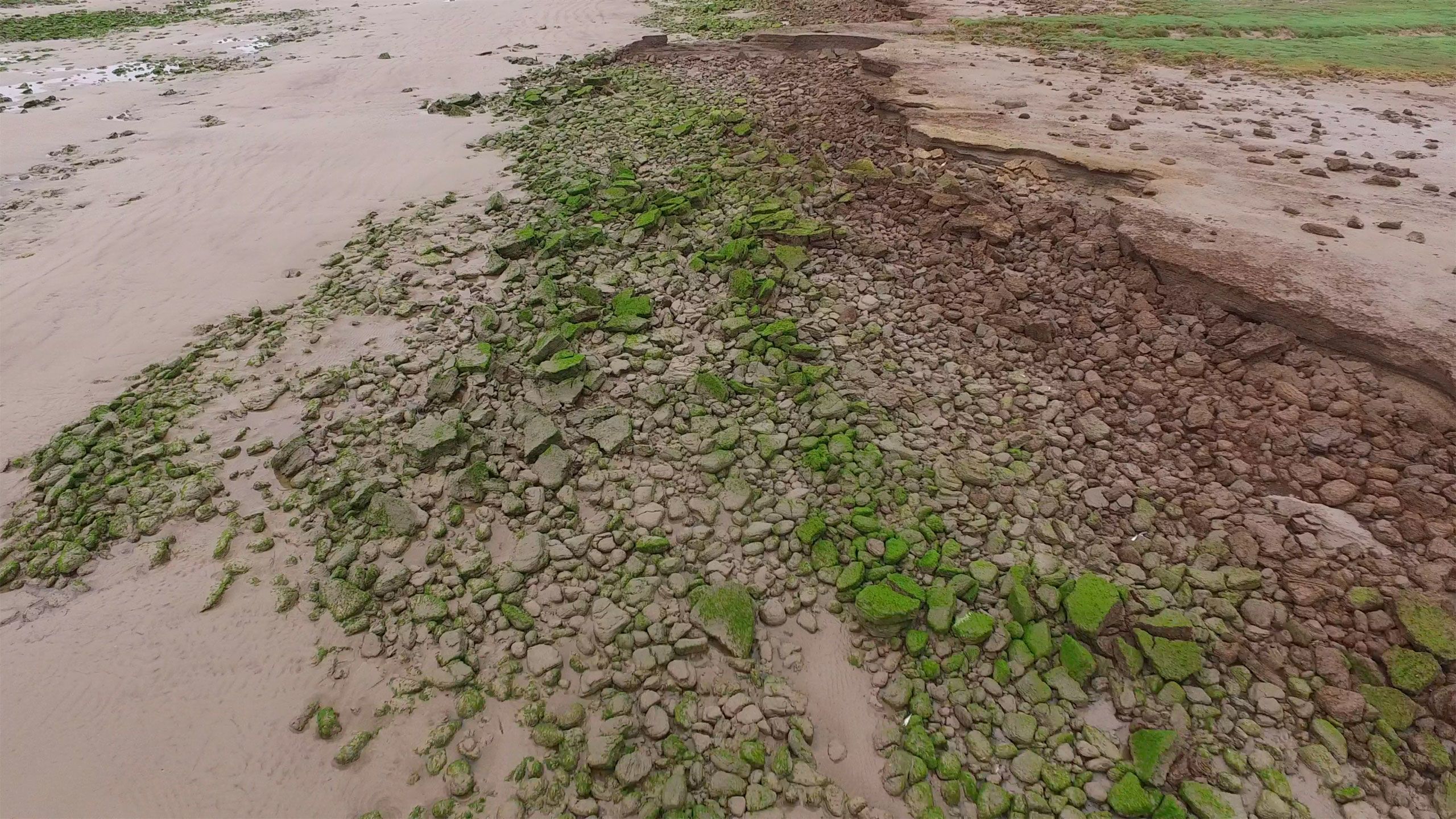
“The mud flats, estuaries and salt marshes along the eastern coast have an important protective function.”
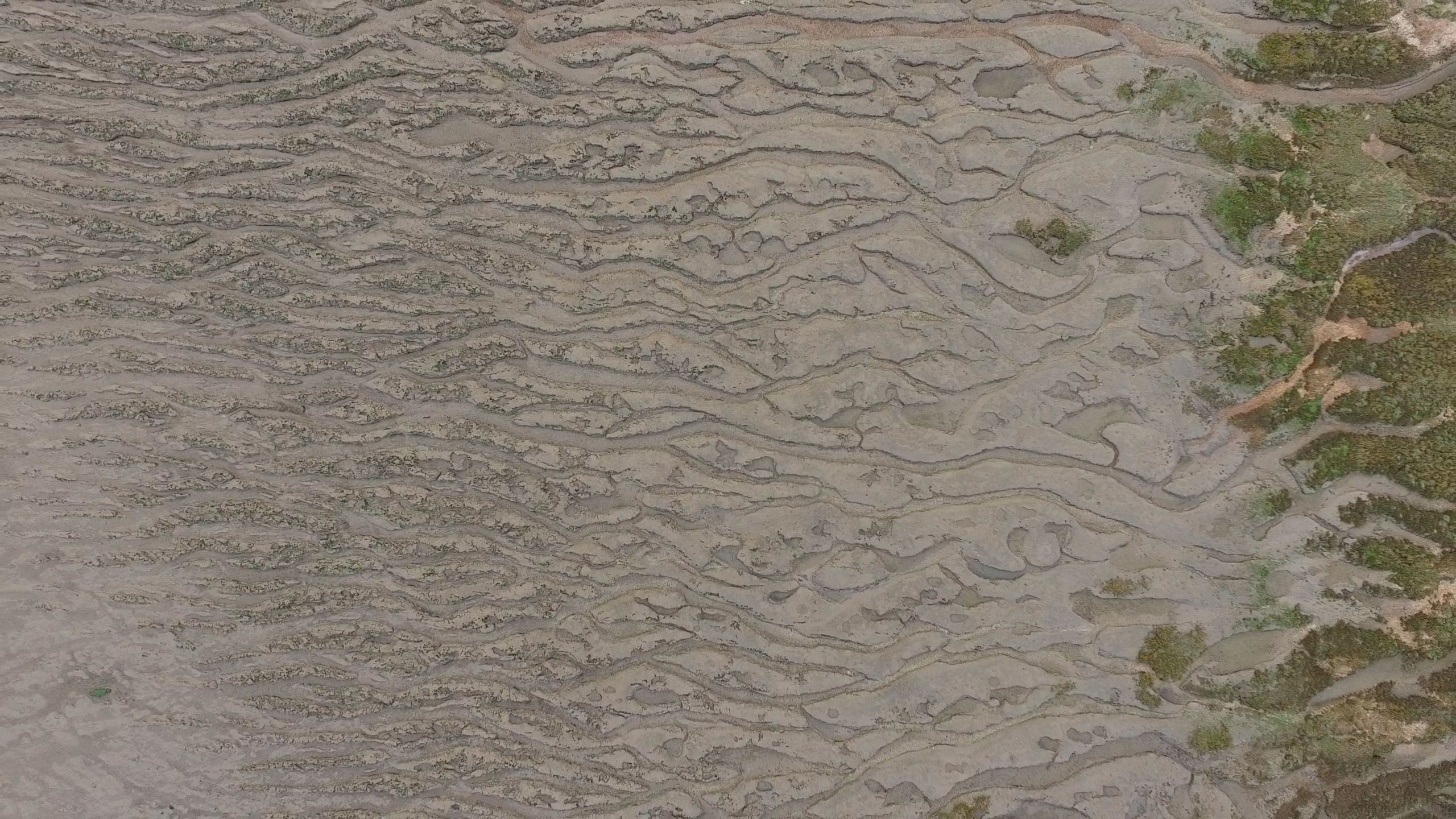
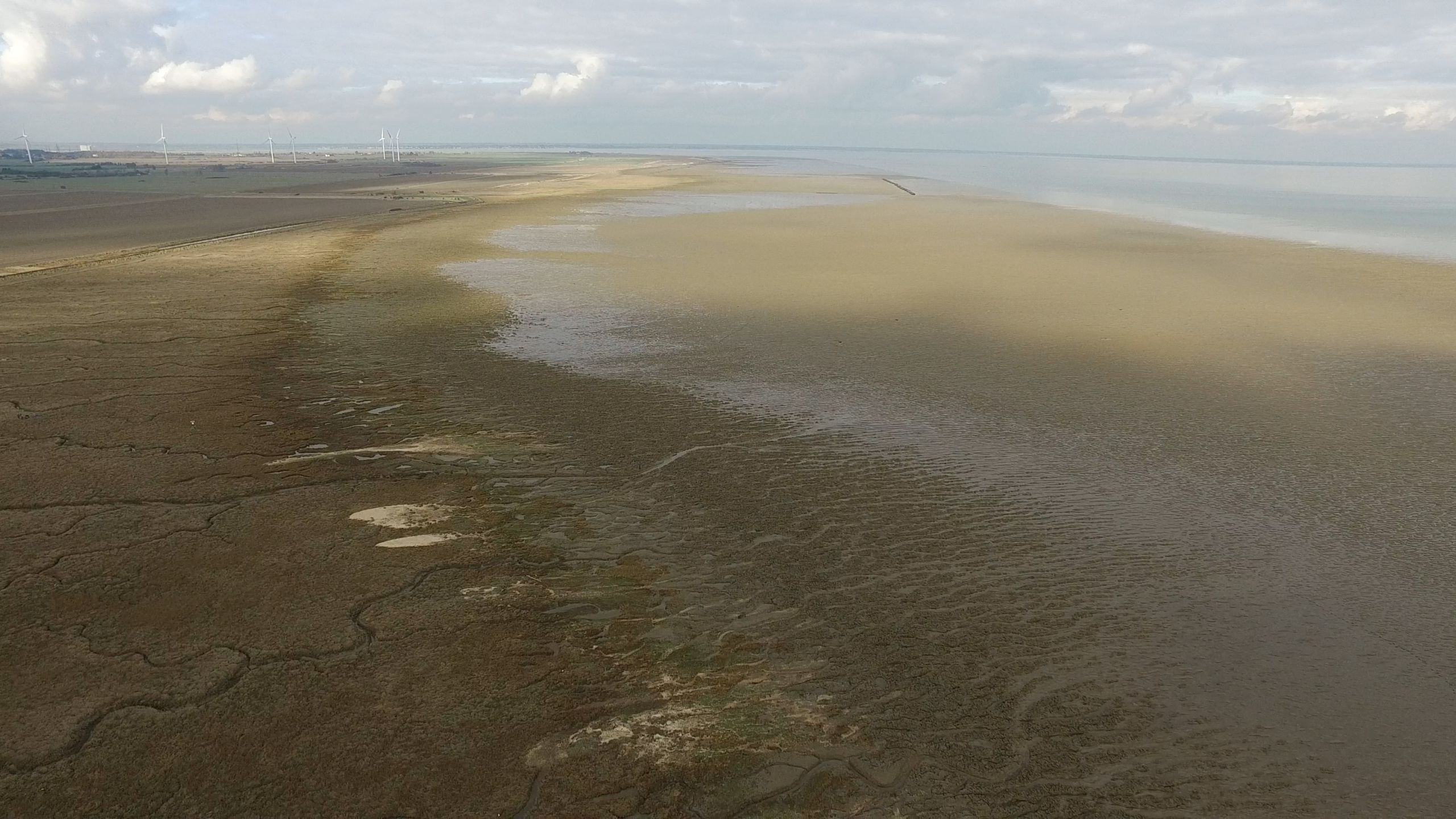
With much of its flat, marshy landscape lying at, or just above, sea level, the East of England is particularly vulnerable to coastal erosion and flooding. According to the most recent UK Climate Projections, the region could see anywhere up to 1.15 m of sea level rise by 2100. It is also home to some of the richest farmland in the country, vital national infrastructure and major tourist areas such as the Norfolk Broads.


The coastal landscapes of the East of England also help protect the coast and those who rely on it by reducing the damage that storm surges can do. “One of the interesting things over my career has been the change in view of these sorts of landscapes, from being areas of relatively low value, to now, where they are rightly viewed as being very important,” says Spencer.
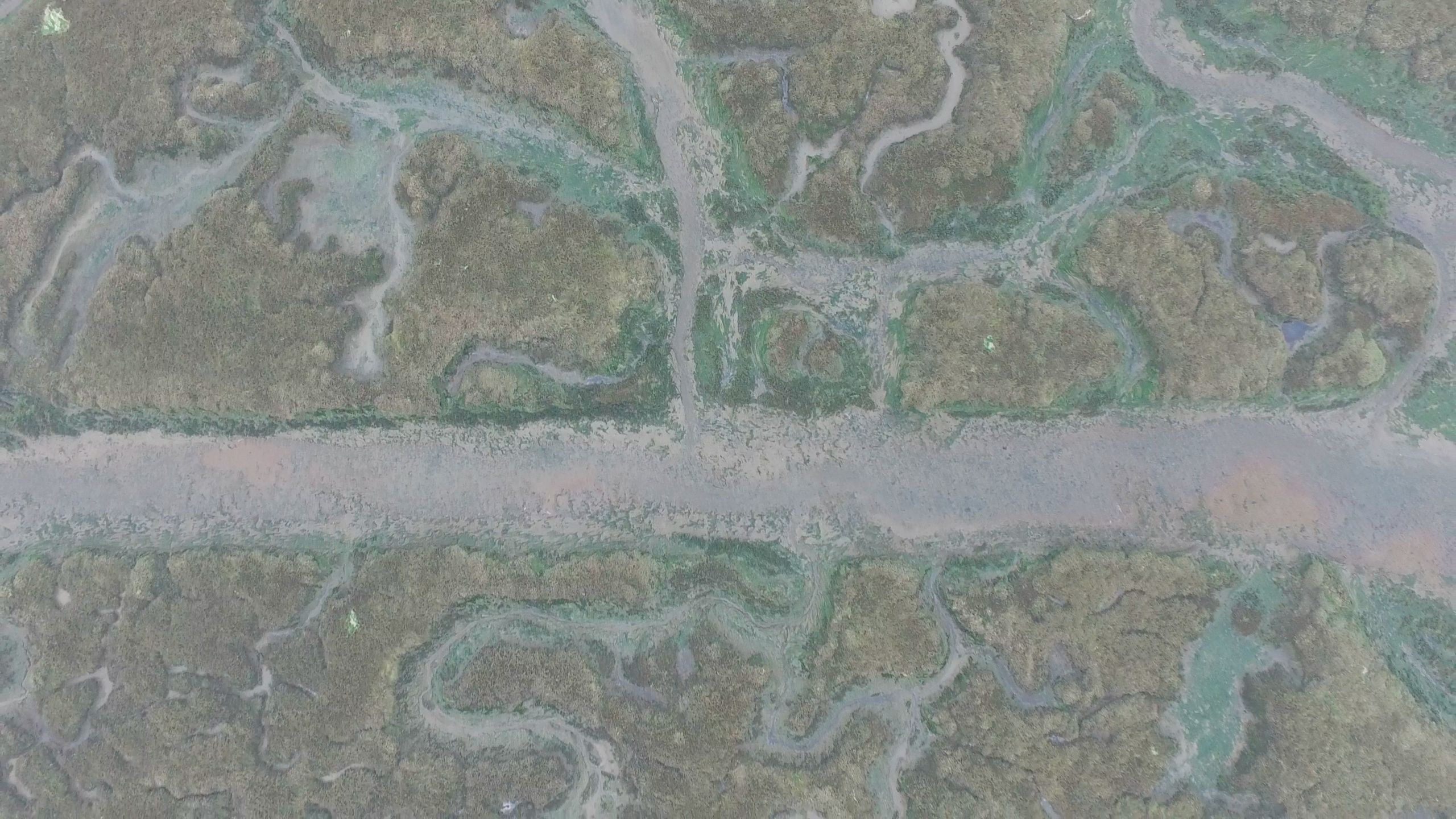
“The mud flats, estuaries and salt marshes along the eastern coast are not only areas of high biodiversity and effective carbon stores, but they also have an important protective function,” says Möller. “We’ve shown in tests that they are highly effective at buffering waves in front of hard defence lines, reducing the waves’ height and potential for damage. To protect our coastal communities and infrastructure, we need to start thinking about having a coastal zone incorporating natural defences, rather than a hard coastal line alone.”
In large-scale tests funded by the EU and the Natural Environment Research Council, Möller and colleagues have shown that even in extreme conditions, narrow fringes of salt marsh just 40 m wide can reduce the height of waves by close to 20%, while an 80 m width of salt marsh can reduce waves to near zero.
“ Good science helps us make good decisions.”
The Cambridge researchers, along with colleagues from UEA and Essex, are working with the Suffolk Coast & Heaths Area of Outstanding National Beauty (AONB) to test how effective salt marshes and other ‘natural capital’ assets are. The Suffolk AONB was chosen to host one of four Pioneer projects, funded by the UK Department for Environment, Food and Rural Affairs (Defra) to inform implementation of the government’s 25-year environment plan, announced in January 2018.
“The coastal sediment is so soft in this part of the country,” says Peter Cosgrove, Marine Pioneer Project Manager at Suffolk AONB. “Large swathes of hard defences aren’t practical here, which is why the Suffolk Coast is an ideal site for the Pioneer project: we can look at different ways to work with nature to protect this magnificent landscape which attracted the AONB designation.”
The work of Möller, Spencer and their academic collaborators is fundamental to the Suffolk Marine Pioneer project. “We need to understand the quality and quantity of salt marsh that we have, the services it provides and who benefits from those services,” says Cosgrove. “There’s a lot of information to be gathered, and with the best available science, we can build coastal strategies that deliver for the coastal communities.”
The National Trust is a major landowner in East Anglia, and is also working with the researchers to build coastal adaptation strategies for the next century and beyond. With natural flood management funding from Defra, the team is quantifying the effects of salt marshes on wave decay and water movements. Having looked at the conditions on the open coast, this work is now looking in the upper areas of estuaries.
“Part of the advantage of working with Tom and Iris is that they have long-term thinking embedded into everything they do,” says Daniel Leggett, Coastal Projects Manager for the National Trust. “We’ve got a responsibility to the properties we own to manage them for the future, so we want to know about the range of changes that might happen and plan accordingly.”
He adds: “With a changing climate and dynamic coastline, it may not be possible to keep everything where it is now. The National Trust will live well beyond my lifetime, so it’s important for us to develop plans which enable us to adapt to a changing environment so we don’t lose all of this: we’ve got to put our resources where they’ll do the most good over the long term. That’s what we get from working with Tom, Iris and their team: good science helps us make good decisions.”
“In addition to developing better coastal defences, we also need to work with coastal communities to help them adapt to a changing coastline,” adds Möller. “It's not about controlling nature but about working with it as part of coastal management.”
(Winner in the 'video' category of the Earth Photo 2019 competition and shown at the associated exhibition at the Royal Geographical Society)