John Speed’s Theatre of the Empire of Great Britaine is one of the world’s great cartographic treasures.
John Speed’s Theatre of the Empire of Great Britaine is one of the world’s great cartographic treasures.
What is it?
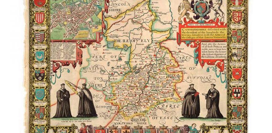
John Speed’s Theatre of the Empire of Great Britaine is one of the world’s great cartographic treasures. Published in 1611/12, it marked the first time that comprehensive plans of English and Welsh counties and towns were made available in print. The Cambridgeshire sheet includes portraits of robed academics, as well as 24 coats of arms of the University, colleges and local nobility.
Why is it so special/ what is the story?
The Theatre was an immediate success: the first print run of around 500 copies must have sold quickly because many editions followed and, by the time of the 1627 edition, the atlas cost 40 shillings. It was a supreme achievement in British cartography. It made John Speed into one of the most famous of all our map-makers and became the blueprint for folio atlases until the mid-18th century.
Can we see it?
The map will be featured in pre-booked tours of Cambridge University Library taking place on Friday 9th and Saturday 10th September as part of the Open Cambridge weekend. Please note that the map is not currently on general public display.
Want to know more?
To celebrate the Theatre’s 400th anniversary, Cambridge University Library has digitized each of the proof maps and put them online. Read the full story and view the digitized images online at: http://www.lib.cam.ac.uk/deptserv/maps/speed.html

This work is licensed under a Creative Commons Licence. If you use this content on your site please link back to this page.


